
Old Maps on Google Earth
published: Mon, 13-Nov-2006 | updated: Fri, 5-Aug-2016
In my review of The Prestige, I stated that the Aldwych in London is semicircular (just about), whereas the one we see in the movie is straight. Well, the mini-goof is actually a little more than that...
Completely coincidentally, a friend sent me an email to say that Google Earth now has several old maps and globes that have been incorporated in its database. One of them is a map of London dated 1843.
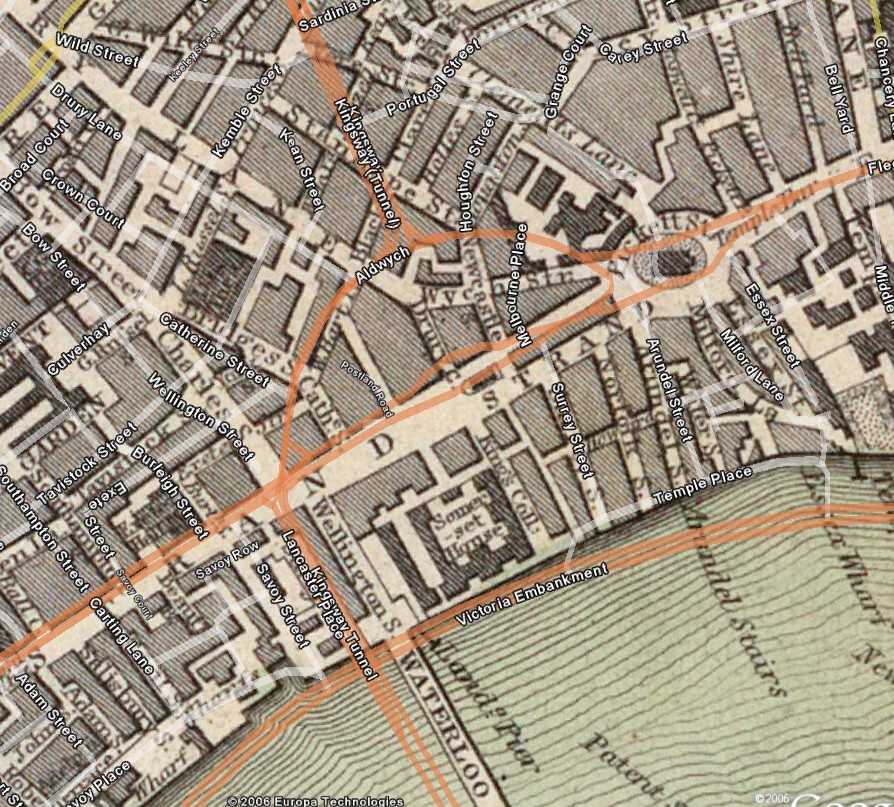
The whole thing is just way cool, jaw dropping even, not only because you can get a feel for old London and how the centre used to look, but also because you can superimpose the current street map on top and see how an area has changed over the last 160 years. Here's an example that shows the area that the Aldwych now covers. Yep, in the early Victorian map (Victoria had been on the throne 6 years) it's not even there. The closest match is a Wych Street. Which led me to do a little research. Apparently, the whole Aldwych-Kingsway area was redeveloped to remove a ghastly set of slums into its current form around 1900, which is roughly the setting of the film. So not only is Aldwych a semicircle, but it didn't even exist at the time the film takes place.
The registration of the old and new maps is not quite 100%, but it's not that far off. It's certainly enough to notice a couple of things. First is the Victoria Embankment seems to be in the middle of the river. Well, that's due to a Victorian engineer called Joseph Bazalgette who had to solve the nasty problem of sewerage in London. The river Fleet was essentially a raw sewer at this time (nowadays, it's now completely underground). As part of doing this work (the first modern sewerage system in the world), he also had to help solve the traffic congestion along the Strand and Fleet Street. He did it by building out into the river, narrowing it, to form a new embankment. Not only did he put the new road on it, but he also added some new formal gardens. This work was completed in 1870.
Second, even then, St Clement Danes Church was on an island with streets either side. Back then it was wedged in between Pickett Street to the north and the Strand to the south, whereas today the Strand just wraps around it, with traffic going round it. (St Clement Danes is one of the two St Clement churches that tries to lay claim to the nursery rhyme, Oranges and Lemons, and its bells actually ring our that tune.)
Third, you can see where I went to university at King's College. On the Victorian map, King's is marked as a street (I presume the remains of this street is the quadrangle in front of the main building), but nowadays it extends from that old street to Surrey Street to the east.